
Frequently Asked Questions
Named one of National Geographic Traveler’s 20 must-see places in the world, Haida Gwaii rewards the visitor who asks questions.
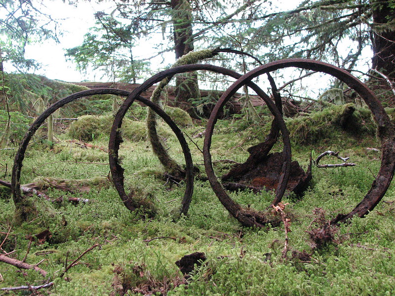
Barrel hoops? Bark peelers? Crab traps? What did these giant rings do in the 1940s on Louise Island? We don’t know — but what we do know, you’ll find here.
The best information about Haida Gwaii doesn’t live on a website. It lives in the people who drive these roads every day, who know which trail is washed out this week, which restaurant opened for the season, and where the eagles are nesting right now.
The questions below are a starting point. When you’re on the islands, come in and ask us directly — the answer you get will be alive to your touring style.
What People Ask Us
What is open on Sunday?
Most businesses on Haida Gwaii are closed on Sundays, including many restaurants and shops. The BC Ferries inter-island service runs on Sundays, and most accommodation is available across the islands. We recommend calling ahead for anything specific. When we are open, we can tell you exactly what is running that day — hours vary by season, so check our current hours before you visit.
How should we spend five days on Haida Gwaii?
Five days is enough to get a real sense of the islands if you are organized. A rough shape that works well:
- Day 1 — Arrive, settle in Daajing Giids. Walk the Seawalk, visit the Haida Heritage Centre in Skidegate. Get oriented.
- Day 2 — Drive north. Stop in Tlell, Port Clements, continue to Masset and Old Massett. Tow Hill and the North Beach at Naikoon Provincial Park are not optional.
- Day 3 — A boat tour into Gwaii Haanas if you have booked one. This requires advance planning — tours fill weeks ahead in summer.
- Day 4 — Slower day. Drive the Rennell Sound road to the west coast if conditions allow. Kayak, fish, or simply sit somewhere quiet.
- Day 5 — Yakoun Lake. Walk through old-growth forest to a large, pristine lake that has never known a motor on its surface. Then catch your ferry or flight.
Come in and talk to us — the best five days depends on who you are and what matters to you.
Are there shuttle services from the airports?
From Sandspit Airport to downtown Daajing Giids daily. Pickups and drop-offs by reservation at Eagle Transit · 250-876-1866.
Masset Airport has no shuttle, but Masset Car and Truck rentals will deliver your rental car from the airport.
Is there any public transportation?
The Northern Health Connector bus runs Monday to Friday, departing Masset at 8:45am, returning from Daajing Giids at 2:45pm. Reserve 48 hours in advance: 250-559-4461.
BC Ferries travels hourly between Alliford Bay on Moresby and Skidegate Landing on Graham.
How about taxis?
Gwaii Taxi And Tours · 1-250-637-1162
Where can I see old growth forests?
The largest stands are in Gwaii Haanas National Park, which requires visitor registration.
Smaller stands on Graham Island are accessible without registering — see Hike Haida Gwaii. Note that trail descriptions use words like “alley” and “trees” rather than “forests.”
How does Haida Gwaii compare to BC for old growth conservation?
View old growth maps at Ancient Forests — BC Government.
Do I need to register to visit Haida Gwaii?
Registration for an orientation session is mandatory to visit the southern half of the archipelago. Book through Parks Canada or your tour guide.
The northern portion of Moresby and all of Graham Island are open without formal registration. Visitors are encouraged to take the Visitors’ Pledge.
How far ahead should I reserve?
May through September: about a month ahead.
October through April: a week ahead should be fine.
If I take a tour, where can I park?
The Daajing Giids Visitor Centre has two overnight parking spots. A dozen or so additional spots are available at the head of the dock where tour operators gather. All parking is first come, first served.
Is there somewhere to board my dog?
Yes — there are two dog boarding services on the islands, one in the mid-island area and one in the north. Supply is limited and they book up in peak season. Stop in or call us for current contact information: 250-559-8316.
Where are some trails near Daajing Giids?
The Daajing Giids Seawalk starts at the Visitor Centre and follows the waterfront — a pleasant short walk with good views across Skidegate Inlet.
For something more substantial, the Tarundl Loop at Kagan Bay Recreation Site is about four kilometres south of town. The trail follows a beautiful estuary and is one of the quieter, less-visited spots near Daajing Giids. Well worth the short drive.
Gore Brook Trail and Crabapple Creek Trail are two further community trails within the village itself. We can point you to trails suited to your time and fitness level — just ask.
How do I pronounce “Daajing Giids”?
The closest English equivalent is “dodging geese.” It means “common hat” in the southern Haida dialect.
Where can I get a coffee?
See our food guide for what is open and when. We can also offer a printed list if you drop by during open hours.
How do I get from Graham to Moresby Island?
BC Ferries operates the Kwuna inter-island ferry between Alliford Bay and Skidegate Landing on a near-hourly schedule, 7am – 10:30pm, with some additional evening sailings. Seasonal schedule.
Where can I fill up my vehicle with propane?
Only in Masset at Coastal Propane: 250-626-5068. See their Facebook page.
Where can I get updates on trail conditions?
Hike Haida Gwaii shares updates on less well-known and user-maintained trails. Note: contrary to information at Hike Haida Gwaii, the Golden Spruce Trail is open again as of March 2025.
What are the distances between villages?
- Daajing Giids to Sandspit — 14 km + 25 minute ferry
- Daajing Giids to Skidegate — 7 km
- Daajing Giids to Tlell — 47 km
- Daajing Giids to Port Clements — 68 km
- Daajing Giids to Masset — 108 km
- Daajing Giids to Old Massett — 112 km
- Daajing Giids to Taw Tldaaw / Tow Hill — 138 km
Are there wheelchair accessible accommodations and activities?
We are building a list. Meanwhile, see this review by Emma Kivisild.
Can I find an expedition off the beaten track?
For guided challenging hikes and climbs, contact the Gould Beach House in Sandspit.
What is a must-see?
Three things we would not leave Haida Gwaii without:
- The Haida Heritage Centre at Kay Llnagaay in Skidegate — one of the finest cultural centres in Canada. Allow at least half a day.
- SGang Gwaay (Anthony Island) — a UNESCO World Heritage Site in the southern reaches of Gwaii Haanas. The standing mortuary poles at the abandoned village of Ninstints are among the most significant and moving sites in the country. Accessible only by boat or floatplane, by permit, accompanied by a Haida Watchman.
- Naikoon Provincial Park — specifically Tow Hill and the North Beach. The scale of the landscape — old growth, open ocean, and the feeling of genuine remoteness — is difficult to describe to someone who has not been there.
What is your favourite place?
Yakoun Lake.
You reach it on foot through old-growth forest — the trees are large and old in the way that makes you recalibrate what those words mean. The lake itself is large, pristine, and completely still. No motors have ever run on it. On a clear day the reflections are perfect.
It is not the most famous place on the islands, and it does not need to be.
Can I make a FAQ suggestion?
Please do. Fill out our Contact Form, call 250-559-8316, or email info@dginfo.ca. Include “FAQ” in the subject.
Have a question that isn’t here? Let us know and we’ll add it.
Quick Facts
Half of the population of Haida Gwaii are Haida First Nations.
“Haida Gwaii” means “islands of the people” in the local language.
Gwaii Haanas National Park is the first area in the world protected from mountain top to sea floor.
52% of the land mass lies within protected areas.
The archipelago is comprised of more than 200 islands.
About 4,500 people live on Haida Gwaii.
The ubiquitous Sitka Blacktail Deer are an introduced species, as are red squirrels, raccoons, beavers, muskrats, rats, and elk.
Places to Know
Gwaii Haanas National Park
Remote rainforest, thousand-year-old trees, ancient totem poles, and abundant wildlife. Visitor registration is required. The first area in the world protected from mountain top to sea floor.
Plan a visitHaida Heritage Centre at Kaay Llnagaay
50,000 square feet of Haida culture — hand-carved totem poles, the Canoe House, the Haida Gwaii Museum, and an authentic gift shop. Allow a full half-day.
Plan a visitNaikoon Provincial Park
726 square kilometres of coastal rainforest, ocean views from Tow Hill, blowholes along the Blow Hole Boardwalk, and the 10 km trek to the Pesuta Shipwreck.
Plan a visitWhale Watching
Orcas year-round. Humpbacks February to fall. Gray whales March to June. Home to half of BC's sea lion population and more than 200 bird species. Advance booking recommended.
Find a guideG̲andll K'in Gwaay.yaay — Hotspring Island
Hot water is flowing again in the sacred pools of Gwaii Haanas after a 7.8 earthquake emptied them. Over a dozen warm pools, historically used by the Haida for their healing properties. Access by permit only.
ReservationsA Word about Logging Roads
If you are travelling the backroads without a local guide, consult current information on closures, deactivations, and industrial traffic conditions before you go. Taan Forest is the primary holder of Tree Farm Licence 47 (TFL 47). They will have information about which independent contractors are currently active on the forestry service roads on Graham and Moresby Islands. Contact their office at 1-250-559-2337.
- Resource road safety information — Haida Gwaii
- Proposed deactivations map (PDF)
- Resource Road Orientation Video
- Natural Resource Enquiries (Forestry Frontdesk)
Bridges: Most bridges on resource roads are one lane. Yield to oncoming traffic.
Road damage: Resource roads may sustain damage from frost, flooding, or vandalism. Damage might not be marked. Expect rough surfaces, potholes, washouts, and cross ditches.
Communication: Industrial traffic uses two-way radios. If you have one, ensure it is programmed with the channels posted at the start of active logging roads.
Still Have a Question?
Our staff are trained Information Counsellors. Drop by the Visitor Centre or get in touch — the answer you need is probably one question away.